Dec 072018


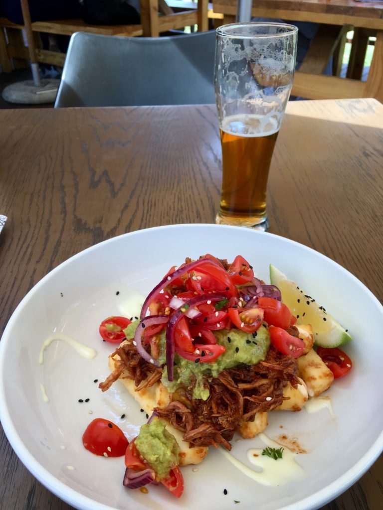
After a great night’s sleep I finally felt a bit more adjusted to the time zone, and ready to have a full day. The weather was gorgeous, if not a little warm, so enjoyed a nice relaxing morning coffee and breakfast outside before heading to the Gautrain for the ride up to Pretoria to meet a friend for lunch. Delicious lunch of BBQ pulled pork over grilled halloumi cheese along with tomatoes and onions…and a couple of local beers as well of course. Was great to just sit out in the garden and enjoy the nice warm weather and catch up with friends.

After lunch, it was still pretty early afternoon, so I decided to go see one of the few sights in the Johannesburg/Pretoria region that I haven’t seen before – the Voortrekker Monument. Grabbed an Uber right from the restaurant, and about 20 minutes later was at the monument, which is situated on the southwest edge of Pretoria.

Completed in 1949, the Voortrekker Monument was built to commemorate the Voortrekkers who left the Cape Colony between 1835 and 1854 by covered wagon into the interior to live in areas that weren’t controlled by the British at the time.

Each of the four corners of the monument has a statue of an important Voortrekker leader, the one below is Piet Retief (who the town of Pietermaritzburg is named for), one of the governors during the Great Trek…who also wasn’t beyond some seriously controversial moments when he came into contact with people already living in the area.

Artsy shot from another corner:

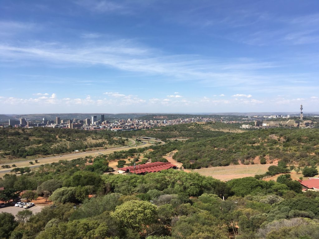
Great view from the top out over Pretoria:

Cascading archways around the top of the monument:

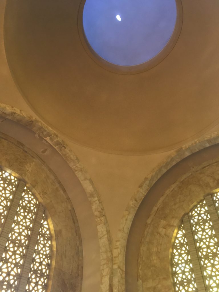
The inside of the main hall of the monument. The monument is 40 meters high, 40 meters wide, and 40 meters long. You can see the opening in the middle through which you can look down into the “crypt” below, which has an interesting museum on the history of the Voortrekkers.

There’s an opening in the dome that you can see below, and at noon on December 16 every year the sunlight comes directly through and lights up the cenotaph below, highlighting the phrase “Ons vir Jou, Suid Afrika” (Afrikaans for “we’re for you, South Africa”) on top of the cenotaph. The date is significant because December 16, 1838 was the date of the Battle of Blood River when 470 Voortrekkers led by Andries Pretorius fought somewhere between 10 and 15,000 Zulus

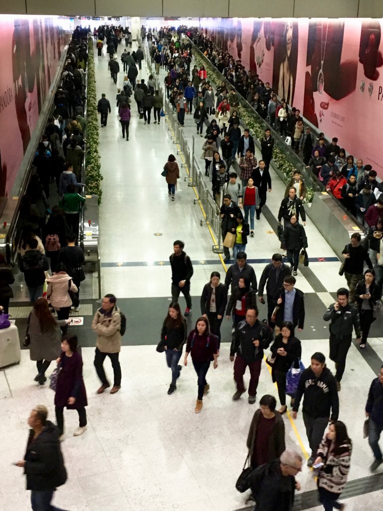
After lunch and the visit to the memorial, I caught an Uber back to the train station, and took the train back to Johannesburg. Ads inside the train station showed the US doesn’t have a monopoly on cheesy reality tv. An ad for a show called “Boer Soek ‘n Vrou” or “Farmer Seeks a Wife.”

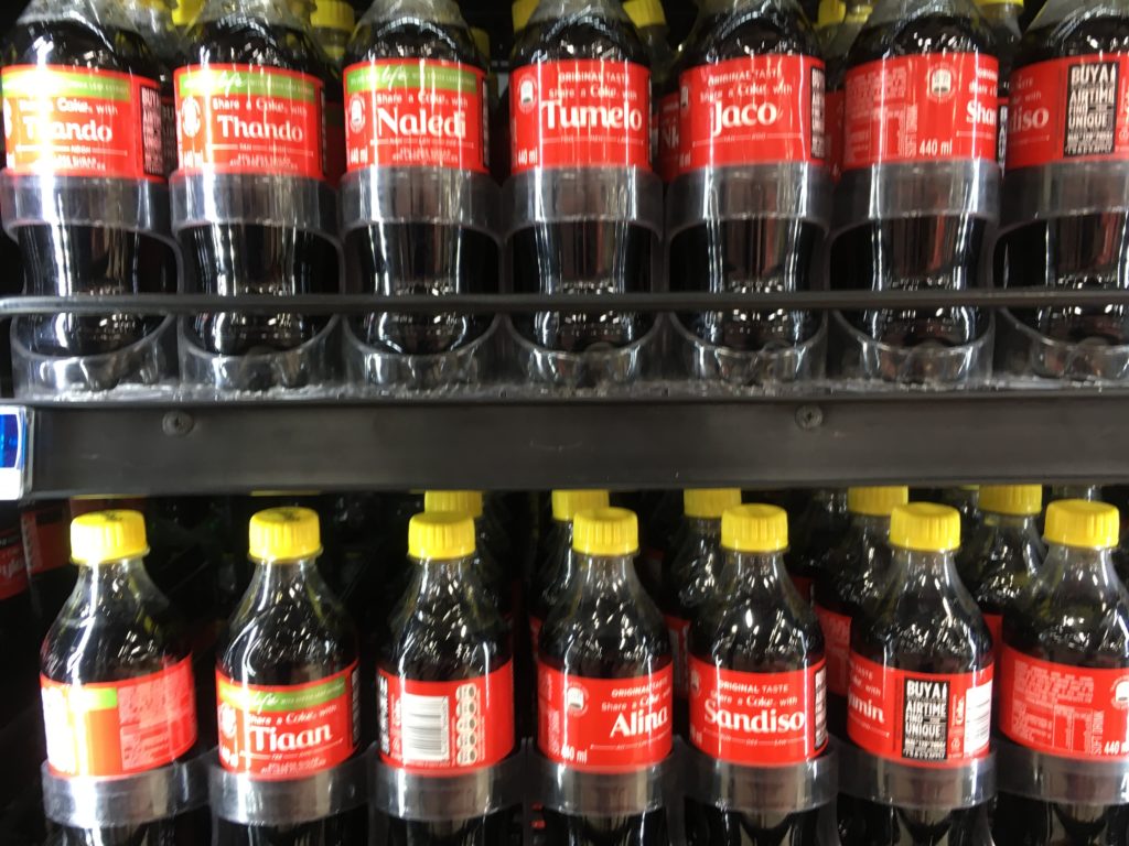
Stopped at the store to pick up a Diet Coke. I’ve always been amused by the “Share a Coke with…” campaign, and the names on display let you know you’re definitely not in Kansas anymore!

Dinner with a couple more friends, but no more pictures. I had actually expected this to be a much longer entry, but it says something about the quality of the time you had that you were too busy enjoying and catching up than taking pictures. It was a relatively short period of time in South Africa, but had been a wonderful way to spend the time between Cairo flights, and I was looking forward to some of the stops on the way back home as well.

Next up, headed back to Cairo, the very long way…

Feb 242017
 

It was already late when we landed in Hong Kong, and by the time I took the airport express into the city and checked into my hotel – the W Hong Kong – I was still full enough from eating on the plane that I wasn’t really feeling dinner. Decided instead to go have a good walk around to stretch out the legs and grab a few drinks before checking in for the night.

The W had upgraded to me to a nice suite with ice cold air conditioning, but even with this the jetlag was catching up to me and I was up nice and early in the morning. I went to bed telling myself I wasn’t going to set an alarm just to get up and see the sunrise, but jetlag conspired to wake me up early anyways, so off I went.

I had seen on FlyerTalk from someone who did a similar trip to mine just a couple weeks before that sunrise on The Peak could be awesome, so I caught an Uber up to the top to see if I could see it. Unfortunately, my Uber got slightly lost, so by the time I found the path, the first signs of sunrise were already out. Still was a very dark walk for the first part down to the observation point.

IMG_6079

Sun just moments away from breaking the horizon, with a great view of Hong Kong Harbour.

IMG_6086

Sunrise over Hong Kong, framed by a small tree.

IMG_6132

It’s a beautiful day….

IMG_6134

The sunrise cast a nice glow over some of the skyscrapers.

IMG_6137

Pro tip from Google – ask your taxi/Uber to take you to the top of Lugard Road, and follow it to the observation point.

IMG_6139

Rather than head back the way I came, I decided to walk down from the Peak. I would regret this the next day, with extremely sore calves and glutes from all the downhill.

IMG_6142

Part of the “Morning Trail” down from the Peak.

IMG_6145

Fortunately, we were heading downhill, because I was really starting to feel it in my legs. Just about when I was realizing I wasn’t 21 any more, we passed the Fitness Corner for the Elderly. All these flavours Hong Kong and you had to choose to be salty?!

IMG_6148

Trail eventually ended at the University of Hong Kong, where I had a nice wander through the campus.

IMG_6149

Sun Yat Sen meditation pond.

IMG_6150

Seniors doing Tai Chi in the middle of campus.

IMG_6151

…and I found Starbucks. Perfect end to a nice hike, sitting outside in the cool weather enjoying some coffee.

IMG_6152

After this decided a bit more walking was in order, so walked for another hour or so all the way to the Star Ferry pier. I hadn’t taken the Star Ferry in years, so figured since I was out playing tourist I might as well make the most of it.

IMG_6165

After the ferry docked I ended up taking a short nap while the iDevices recharged, and then it was off for some lunch. I wanted to go back to the Island for lunch, and debated taking the train, but it was so nice out that I decided another ride on the Star Ferry was in order. Heading back to Tsim Sha Tsui:

IMG_6168

Grabbed lunch a fun little brewpub I like called The Roundhouse which serves amazing brisket, then, a bit of wandering the chaotic streets of Hong Kong:

IMG_6178

Taking the mid-levels elevators:

IMG_6184

Typical Hong Kong street scene:

IMG_6188

After a couple more hours of walking, it was back on the crammed rush hour subway to my hotel:

IMG_6189

Met up with a friend for dinner near the hotel before crashing relatively early. It had been a really early morning, and I had to be up very early again the next morning to catch my flight to Singapore. It had been a wonderfully active day, and I forgot how much I’ve missed visiting destinations where you can just spend the entire day walking around. You can’t really do that in Afghanistan, Congo, etc…

Next up, Singapore First Class to Australia!

Jan 192013
 

On day three, we once again got a not-too-early start at 9am for the drive to what was promised to be the highlight of the trip: the ruins of Leptis Magna. Leptis Magna is located around 130 km to the east of Tripoli, and the road is in pretty good shape the whole way. The drive took nearly two hours, but that is because the suburbs of Tripoli just sprawl and sprawl, and it was a good while before we were able to get any decent speed going.

Leptis Magna was initially founded somewhere around 1100 BC by the Phonecians, and really finally grew under Carthage around 400 BC. Around 200 BC it was conquered by the Romans in the Punic Wars, and that’s when it really began to thrive, and it’s that period that most of the ruins seem to be from, although some go back to the times of Carthage as well. Around 400 AD the Vandals conquered Leptis Magna, and it declined relatively quickly.

Approaching the ruins, the first ruin we came across was the Arch of Septimus Severus, built in the year 203 AD. It is restored, and thought to be a gift from the Emperor when he returned to Leptis Magna as a gift.

IMG_4390


Continuing past the arch, the next area was the Plastra, a 3rd century courtyard for several different sports.  It was in front of the Hadrian Baths, built under Emperor Hadrian between 126-127 AD.

IMG_4397


Continue reading »

Jul 252012
 

What, you’ve never heard of the Diefenbunker? Well, despite many many trips to Ottawa lately, I hadn’t either until the friend I was staying with mentioned it this weekend. When I heard about it, I knew this was something I had to see.  You’d never see something like this in the United States open to the public…ever!  Way too many “secrets” that could potentially be exposed.  I think the closest I saw was the U.S.S. Pueblo which is currently moored in Pyongyang, North Korea.  Even that has been stripped of anything remotely interesting, so a chance to experience this part of Cold War history was super exciting to me!

Correction:  Appears the Greenbrier Bunker in West Virginia is now open to the public too – however, no pictures allowed!  I know my next weekend trip from D.C.!

So, what is the Diefenbunker?  Also known as Canadian Forces Station Carp, it’s a 4-level underground bunker built outside of Ottawa in order to house the Canadian government in case of imminent nuclear attack.  Named after the 13th Prime Minister of Canada John Diefenbaker, it was just far enough from Ottawa that it was thought to be safe from the main targets (Parliament Hill, Canadian Forces bases,etc) but close enough that essential members of government could be evacuated there on short notice.  Construction began in 1959, and was completed in just a few months.  It was never actually activated, but during the Cuban Missile Crisis preliminary steps were taken to make it operational.

According to Wikipedia: “The underground 4-story bunker was capable of withstanding a near-hit from a nuclear explosion. It had massive blast doors at the surface, as well as extensive air filters to prevent radiation infiltration. Underground storage was built for food, fuel, fresh water, and other supplies for the facility which was capable of supporting several hundred people for weeks. A vault was also constructed on the lowest level to hold the gold reserves of the Bank of Canada

In 1994, after the fall of the Soviet Union, CFS Carp (aka the Diefenbunker) was decommissioned, and in 1998 was re-opened as Canada’s Cold War museum.  You can tour the entire site, and many parts are just as they were left in the 60s and 70s.  After purchasing a ticket at the kiosk outside, there is a small plaque detailing what the site is:

Just past the sign, you enter the building through the massive blast doors:

Continue reading »